From The Asia Foundation (Jun 1):
What’s Next for Mindanao Peace Process Under Duterte Leadership (By
Anna Tasnim Basman, Steven Rood)
In the lead-up to May 9 Philippine elections, anxiety mounted over how the decades-long Bangsamoro peace process to resolve the protracted conflict in Mindanao would continue – if at all – under new leadership. Now, as President-elect Rodrigo Duterte, who will be sworn into office on June 30, sets about naming his new cabinet, peace advocates are watching his next moves carefully.
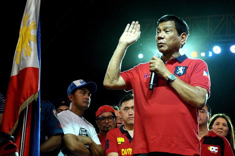
During the campaign season, President-elect Rodrigo Duterte said that he would “put the Mindanao conflict on top of his agenda.” Photo/Rody Duterte Facebook page
In its February 2016
public report about the implementation of the 2014 Comprehensive Agreement on the Bangsamoro (CAB), the Third Party Monitoring Team (TPMT) recognized that the Bangsamoro Basic Law (BBL) had stalled and called for a Plan B “to build a path forward so that the next administration can hit the ground running, and the unavoidable hiatus while the new administration takes stock can be minimized.” However, in a
widely-circulated paper, Judge Soliman Santos argued that it is more important that “the new administration takes stock of the overall situation of the Mindanao peace process than to hit the ground running on the BBL.”
During the campaign season, Duterte
said that he would “put the Mindanao conflict on top of his agenda.” This was warmly welcomed by the two largest Moro Fronts – with Moro National Liberation Front (MNLF) Chairman Nur Misuari explicitly
endorsing his presidency and MILF Vice-Chair Ghadzali Jaafar calling him the “
next president” when Duterte visited Camp Darapanan in February.
Amid this warm reception of Duterte’s presidency are the varying views of his Cabinet members regarding the Bangsamoro peace process –
some are skeptical about it for political, constitutional, or security reasons while others see it as an opportunity to establish a
Bangsamoro Federal State. In the face of these divisions in the Duterte camp, and the wider body politic, returning Presidential Adviser on the Peace Process,
Jesus Dureza, has called for wide-ranging consultations on crafting a new Bangsamoro peace roadmap to include groups outside the Moro Islamic Liberation Front in order to make such a process successful.
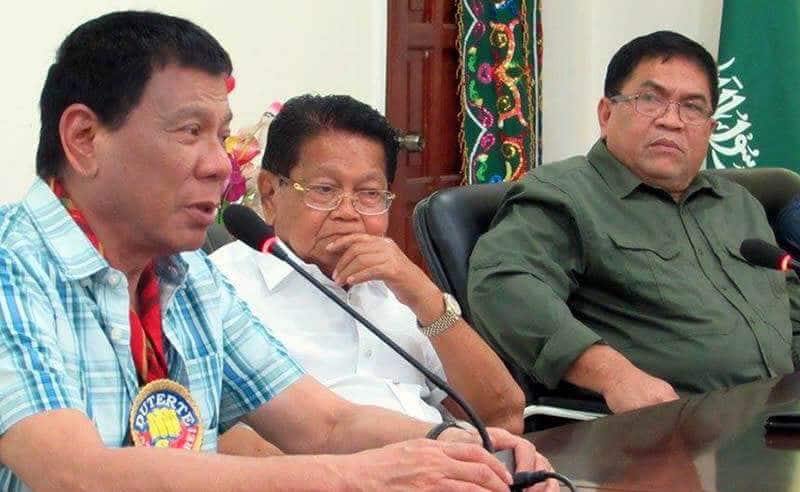
Duterte with Ghadzali Jaafar (middle), MILF vice chair for political affairs, and Bangsamoro Islamic Armed Forces (BIAF) Chief of Staff, Sammy Al-Mansour. Photo/Sammy Al-Mansour Facebook page
So what’s next for the peace process?
Plan A would be to
start where the process stopped: in the May 30 Declaration of Continuity, the government under President Aquino’s administration and MILF peace panels spoke of continued pursuit of a Bangsamoro Basic Law. That might have been more promising had Mar Roxas, the administration’s bet, been elected. In the current situation, when the administration candidate did not win, success with this tactic is
uncertain, to say the least.
There’s a perception within the incoming administration that the Bangsamoro bill was
not inclusive enough because the MNLF had not been consulted. A Plan B then is to move forward in a way that assures the “participation of the MNLF in any transitional authority that will be set up by the new autonomy law,” as stipulated in the
Joint Communique signed by the government and the MNLF in the recently concluded Tripartite Review Process that the Organization of the Islamic Conference hosted in Jeddah. And, an embryonic mechanism exists for MILF-MNLF cooperation, in the
Bangsamoro Coordination Forum, though that has yet to really take off. A definite step in the direction of involving the MNLF is the anticipated visit by president-elect Duterte to Sulu to meet his long-time acquaintance, MNLF Founding Chair
Nur Misuari (which
would be reminiscent of what President Corazon C. Aquino did in 1986).
But even that leaves out other stakeholders, such as local officials who just won the elections in the Autonomous Region in Muslim Mindanao (ARMM) and its provinces, cities, and municipalities. Re-elected Governor Mujiv Hataman has always been supportive of peace process efforts, so he can be an advocate for this. Other officials
expressed skepticism during debates on the Bangsamoro Basic Law, thereby fueling the perception that the process of devising the BBL was not inclusive. Utilizing the ARMM and other local governments for consultations toward a roadmap would help demonstrate that the process is not meant for the MILF alone.
Going beyond a focus on peace in Mindanao is the vow of President-elect Duterte to pursue the shift from a unitary to a federal state structure. Presumptive Speaker of the House Alvarez said that the BBL is “
moot already” because of the thrust toward federalism (the Congressman
later clarified that the government can pursue the BBL alongside the move toward federalism). This
elicited some outrage and
perplexity on the part of the MILF because candidate Duterte had promised to
pass the BBL.
While some argue that the BBL must continue to be fast-tracked, even during a thrust for
federalism, this seems largely to be because of worries about the longer time-frame for constitutional change than for passing a law (since an optimistic time-frame for constitutional change has a plebiscite to ratify amendments coinciding with the May 2019 midterm elections). Both the
MILF and the
MNLF seem to agree that a Bangsamoro self-governing unit within a federal system is an acceptable solution to the Bangsamoro problem. However, they emphasize the need for asymmetry, including recognizing the
Bangsamoro as a nation as well as respecting the 1996 Final Peace Agreement (FPA) and 2014 CAB, so that the special requirements of
solving the Bangsamoro Problem can be met.
The Aquino administration’s goal was always to accomplish the implementation of peace agreements quickly so as to be completed during his term. However, that was not to be. Now, the Philippines will have a new administration which must tackle this issue, and the shortest route –refiling the original bill and persuading the Congress to pass it substantially unchanged – seems very unlikely. All other scenarios – convergence with the MNLF and other sectors, involving the ARMM in consultations, or constitutional change – involve longer time periods.
Crucial during this “hiatus” would be three things. First, maintaining sufficient confidence in the political process, be it related to the MILF or the MNLF, so that armed insurgents do not engage in violent acts, and to demonstrate to those who might be tempted by the siren song of ISIS that a Bangsamoro-specific solution is possible. Second, whatever process ensues, it must be seen to be inclusive in order to demonstrate to the Filipino nation that the outcome is broadly acceptable.
Third, arrangements to address the long-standing poverty and deprivation that has been exacerbated amid the conflict in the region must be made. The MILF has consistently resisted socio-economic development that could be construed as counterinsurgency but has no objection to the expansion of regular government programs serving their communities. MNLF communities have been the subject of
PAMANA and the current and incoming administrations must assess the efficacy of this program.
In this manner, what happens during the hiatus while final legislative or constitutional changes are made is important for the current fragile peace process to be maintained.
[Anna Tasnim Basman is an assistant program officer for The Asia Foundation in the Philippines, and Steven Rood is country representative there. Basman can be reached at annatasnim.basman@asiafoundation.org and Rood at steven.rood@asiafoundation.org and @StevenRoodPH on Twitter. The views and opinions expressed here are those of the authors and not those of The Asia Foundation or its funders.]
http://asiafoundation.org/2016/06/01/whats-next-mindanao-peace-process-duterte-leadership/